Most mapping apps are designed with drivers in mind. A new tool from a Barcelona public agency helps pedestrians avoid the sun on their stroll.
On a hot summer day, a street without trees might feel 15 or 20 degrees hotter than a shaded street nearby. But most mapping tools—designed with drivers in mind—don’t give pedestrians any details about whether a particular route will be a comfortable walk. A new app from a public agency in Barcelona, called Cool Walks, is different, letting users choose the shadiest route between two points.
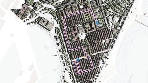
When someone uses the app to get walking directions, there’s an option to see the fastest route. But the app also shows a shady alternative, and a third option called “vampire mode” that lets pedestrians completely avoid the sun. The app also shows the locations of drinking fountains and shelter along the route.
The tool, which only works in one neighborhood for now, was challenging to build. “You need a lot of very detailed data,” says Albert Carbonell, lead analyst at the geographic information systems department at urban planning agency Barcelona Regional, who worked on the project with a team as part of a competition to use public data. Barcelona had already used LIDAR, a kind of remote-sensing technology, to create a three-dimensional model of Barceloneta, a neighborhood on the city’s coast. The data was originally intended to map the risk from sea-level rise, but in the new tool, it helps map the shade from trees and buildings, hour by hour, as the position of the sun changes. The city had also previously studied shade as part of a “tree master plan” to increase Barcelona’s tree canopy from 5% to 30%.
Because most maps look at streets from the perspective of drivers, the developers had to look in more detail at where sidewalks were located. “Since the shading is very different from one sidewalk to another, we needed to look at each sidewalk individually,” says Carbonell. In some cases, paths and public squares offered shortcuts that didn’t show up on standard maps, and the developers had to manually add them in.
It’s something that could be difficult to replicate elsewhere, though as cities make plans to reduce extreme heat, more data may become available about the exact location of shade and sidewalks. Eventually, in an ideal scenario, every street will have enough shade that any route can work. But in the meantime, apps like this could help. Extreme heat is a growing problem almost everywhere, even in cities like Seattle that have historically been fairly cool.
Other institutions are rethinking how to improve maps for pedestrians in different ways. The Turing Institute in London has studied local air pollution and created air quality forecasts that could be incorporated into a recommended walking route (over the last year, they pivoted to study social distancing between pedestrians). Another researcher at the Turing Institute previously considered the possibility of mapping the most beautiful walking routes, using an algorithm that can automatically rate the beauty of a a given location on Google Street View. It’s not clear how much tools like these might be used—someone in a hurry might not want to go out of their way just because a street has cleaner air or more trees. But it’s one more factor that might make it a little more likely that someone chooses to walk rather than drive.